MachairWind will be our first offshore windfarm on the west coast of Scotland. Once complete the offshore windfarm could produce up to 2GW of renewable electricity. Enough to power almost 2 million homes.
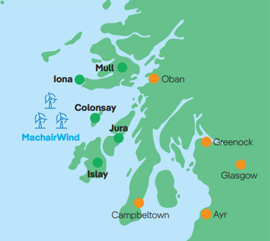
We have started carrying out survey works across the Option Agreement Area, which is shown by the turbines in the map above. The windfarm itself will only cover part of this area and its exact location will be determined by these survey findings.
What wind turbines will be used?
We are currently considering wind turbine options taking into consideration all conditions in and around our Option Area. The number of turbines we install will depend on the technology we select as part of the future detailed project design.
With an average water depth of 55m across the Option Area, we expect to use foundations that are fixed to the seabed for the project, rather than those that are anchored or floating.

Export route and grid connection
The offshore and onshore cable routes are currently being evaluated and will be identified once technical studies, surveys and appropriate consultations with stakeholders have been carried out.
MachairWind’s offshore turbines will export their green electricity to the grid by a subsea cable, that will connect to a substation at an onshore location on the mainland of south-west Scotland. This location will be decided by National Grid.
Engineering surveys
Metocean & LiDAR Surveys
In April 2023, two metocean buoys, two seabed landers and a floating LiDAR (light detection and ranging) buoy were deployed off the coast of Argyll and these instruments continue to gather data about wind speed, air and, sea temperatures, current speeds, and wave heights on the site.
Site investigation surveys
In the summer and autumn of 2023, we undertook geophysical and environmental survey works on the windfarm development area. This involved gathering data about the ground conditions on the seabed. The intention is that further surveys work of this kind will be undertaken later this year.
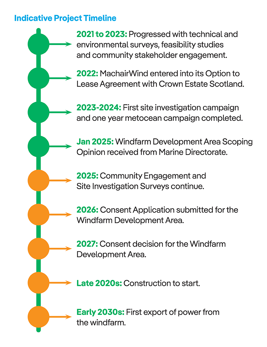
When will MachairWind be operational?