We have:
Undertaken a desk-based study for the Site and a baseline ecological survey for protected species and habitats, including the access route. We have also undertaken breeding bird surveys and great crested newt environmental DNA surveys. A baseline tree survey has also been undertaken.
We found:
The Site does not overlap with any statutory designated sites of nature conservation interest. The closest such site is Arlington Reservoir Site of Special Scientific Interest (SSSI) and Local Nature Reserve (LNR) which is an important ornithological designation, located approximately 0.9 km to the south of the Site. The habitats on Site are dominated by intensively farmed arable fields with grassland buffers bounded by hedgerows and ditches, most of which are dry. There are several woodland blocks and ponds also across the Site. Mature trees are present in the hedgerows and pasture fields. Environmental DNA testing found great crested newts to be present within two of the ponds within the Site. Potentially suitable habitat for both dormouse and reptiles is also present within the Site, although this will be protected during the Proposed Development. Two badger setts are also present within the Site.
What we will do:
SPR will mitigate impacts on ecology in a variety of ways including by retaining the higher value habitat including woodland, ponds, trees and hedgerows with appropriate buffers; existing field accesses will be used, where possible, for internal roads. All works to potential great crested newt habitat will be appropriately licensed and any necessary mitigation included in the project. Other protected species will be similarly protected during works either via timing of activities or through appropriate buffer zones. The final project will ensure significant ecological enhancement to the current baseline through the inclusion of more diverse grasslands (it is intended to use a wildflower seed mix for the grassland beneath the panels), strengthening of hedgerow corridors and planting of new scrub/woodland habitat across the Site. Dedicated areas of habitat creation will be included at the site edges. These will cover some 12+ ha and include a diverse matrix of scrub, grassland and potential for new ponds.
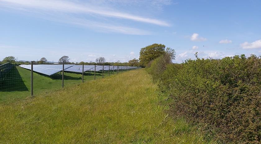
Above: Example of a green corridor and hedgerow adjacent to an existing solar farm.
Full details of the ecological impact, any necessary mitigation, along with enhancement will be provided in the ES to be submitted as part of the planning application.
We have:
Undertaken an agricultural land classification survey of the Site to determine the quality of the fields with respect to their use in agriculture.
We found:
The fields surveyed to date (the majority) are all of the lower Sub-grade 3b, typical of heavy textured Weald Clay soils.

Above: Land at proposed Pollards Solar Farm
What we will do:
Although the soil within the Site is of a lower quality with respect to its use for agriculture, the process of developing the Site into a solar farm will retain the topsoil and, once built, not prejudice its future use for food production.
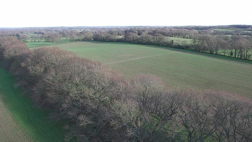
Above: Aerial photo of the Site
We have:
Undertaken a desk-based review to identify all known heritage assets within the Site, also all heritage assets in the vicinity of the Site that may be affected by a change within their setting. A walk-over of the site has also been undertaken.
We found
There are no designated heritage assets (such as listed buildings, scheduled monuments or conservations areas) within the Site. A number of such assets are present within the vicinity (300 m) of the Site, including one scheduled monument and several listed buildings:
- Claverham Manor moated site – Scheduled Monument;
- Claverham Manor – Grade II listed building;
- No. 3 Wick Street – Grade II listed building;
- Candle Cottage – Grade II listed building;
- Wick Street Farmhouse – Grade II listed building;
- Lower Claverham Farmhouse – Grade II listed building; and
- Mount Pleasant Farmhouse – Grade II listed building.
Features of potential archaeological interest within the Site include a possible round barrow (a burial mound likely to be of Bronze Age date) and the putative line of a Roman Road.
What we will do:
SPR will review the design of the Proposed Development in order to eliminate or minimise any harm that could be caused to designated heritage assets as a result of the change within their setting caused by the construction and operation of the Proposed Development. SPR have reviewed the design of the Proposed Development in order to minimise or eliminate any harm that could be caused to designated heritage assets as a result of the change within their setting caused by the construction and operation of the solar farm. This has resulted in the removal of solar panels from land to the east of Claverham Manor and to the south of Mount Pleasant Farmhouse, also the relocation of the proposed substation so that it is further away from Claverham Manor.
SPR will carry out field surveys to further investigate the potential of the Site to contain as-yet unknown archaeological remains, and to provide further information regarding the potential archaeological remains that have been identified by the desk-based assessment. The results of these surveys will then feed into the design process for the Proposed Development and will inform a Heritage Chapter as part of the Environmental Statement to be submitted with the planning application.
We have:
Undertaken surveys and desk assessments to understand the hydrological conditions at the Site to inform the design and to minimise the risk of fluvial and surface water flooding. SPR propose to undertake a surface water drainage strategy to provide attenuation to ensure that the Proposed Development appropriately manages surface water run-off without increasing flood risk. SPR have also undertaken a Water Quality Assessment, to assess the wider hydrological and hydrogeological impacts on the sites in accordance to a screening methodology as dictated by the Water Framework Directive.
We found:
In addition to the main hydrological components of precipitation/rainfall, surface water runoff and infiltration/percolation, we have identified the watercourses flowing through the site and along its boundary (Wick Street Stream and its tributary), and the outline of their floodplain during the design flood events. This allows us to understand the flood mechanisms within the Site, to define the extent of the floodplain associated with the watercourses running along the Site boundaries and through the Site, and to identify surface water runoff flow paths.
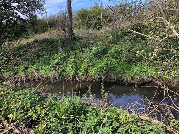
Above: Watercourse currently on Site. Bridge culvert will be implemented to enable access.
The presence of appropriate maintained vegetation at all times across the Site will mitigate potential increases in runoff and soil erosion, which can be a contributing factor to greater runoff.
What we will do:
SPR will avoid the floodplain on Site. During the construction phase, pollution of watercourses will be prevented through a range of good practices, such as the use of silt traps, settlement ponds and cut off drains. This is to ensure that water quality of watercourses, such as Wick Street Stream and its tributaries as well as Cuckmere River, are protected and maintained. A bridge culvert will be constructed where the proposed access road crosses the tributary of Wick Street Stream, downstream of Lower Claverham Farm. The culvert will be sized appropriately in order to convey the flow unobstructed further downstream and in accordance with the Environment Agency's Flood Event requirements.
In addition, any existing field or tile drainage system would be restored where affected by construction. The results of the Flood Risk Assessment will be submitted as part of the planning application.
We have:
Assessed the potential transport and highways impact of the Proposed Development and considered the potential access options. The transport matters have been assessed, operational impacts on the local highway network are anticipated to be low, with only a minimal number of vehicles accessing the Proposed Development every quarter. Thus, operational movements would have a negligible impact. The temporary construction impacts have been considered. The assessment included consideration of different points of access, access details and potential delivery routes for construction vehicles, noting any constraints.
We found:
That there were a number of possible accesses and construction routes to the Proposed Development, with construction vehicles able to route south from the A22 or north from the A27. It is recognised that there are sensitive residential areas are located along all routing options. The access choices have been considered in relation to the possible construction route together with the connection point to the local highway network, internal routing from the local highway network and minimising impacts on residential properties as much as practicably possible. In determining possible accesses local infrastructure, route constraints, sensitive receptors, junction constraints and management measures have been considered. The assessments have identified that the existing access to Lower Claverham Farm adjacent to Batsbrook Farm House offers the best means of access from the public highway. At a point on the access track just before Lower Claverham Farm, a new access track will be provided into the Proposed Development.
What we will do:
We will produce a report detailing access together with analysis of the local network and operational and construction movements. In order to minimise the impact on local road users, prior to commencing construction, a Construction Traffic Management Plan (CTMP) would be produced in agreement with Wealden District Council and East Sussex County Council and detail any potential traffic management measures.
We have:
Undertaken two five-day baseline sound level surveys at locations representative of the nearest residential dwellings to the Proposed Development. The data obtained has been used to inform an assessment of potential noise impacts during the operational of the Proposed Development. The assessment has been undertaken with reference to National and Local planning policy and guidance and in accordance with recognised British Standards.
We found:
The likelihood for adverse impact of noise from the Proposed Development has been continuously assessed during the design process, and the layout refined through the appropriate siting of noise generating plant (inverter units) in relation to identified residential dwellings.
What we will do:
Continue to assess the likelihood for adverse impact in the event that any aspect of the Proposed Development changes. We have moved the inverters further away from residential properties. There will also be screening created by the new enhancement areas. Suggest appropriate mitigation techniques where necessary in order that noise from the Proposed Development is reduced to be as low as reasonably practicable, and such that adverse impacts are unlikely. The results of the assessment will be submitted alongside the planning application.
Go back to the main pageGo to the next page